What Is Aerial Application in Modern Agriculture?
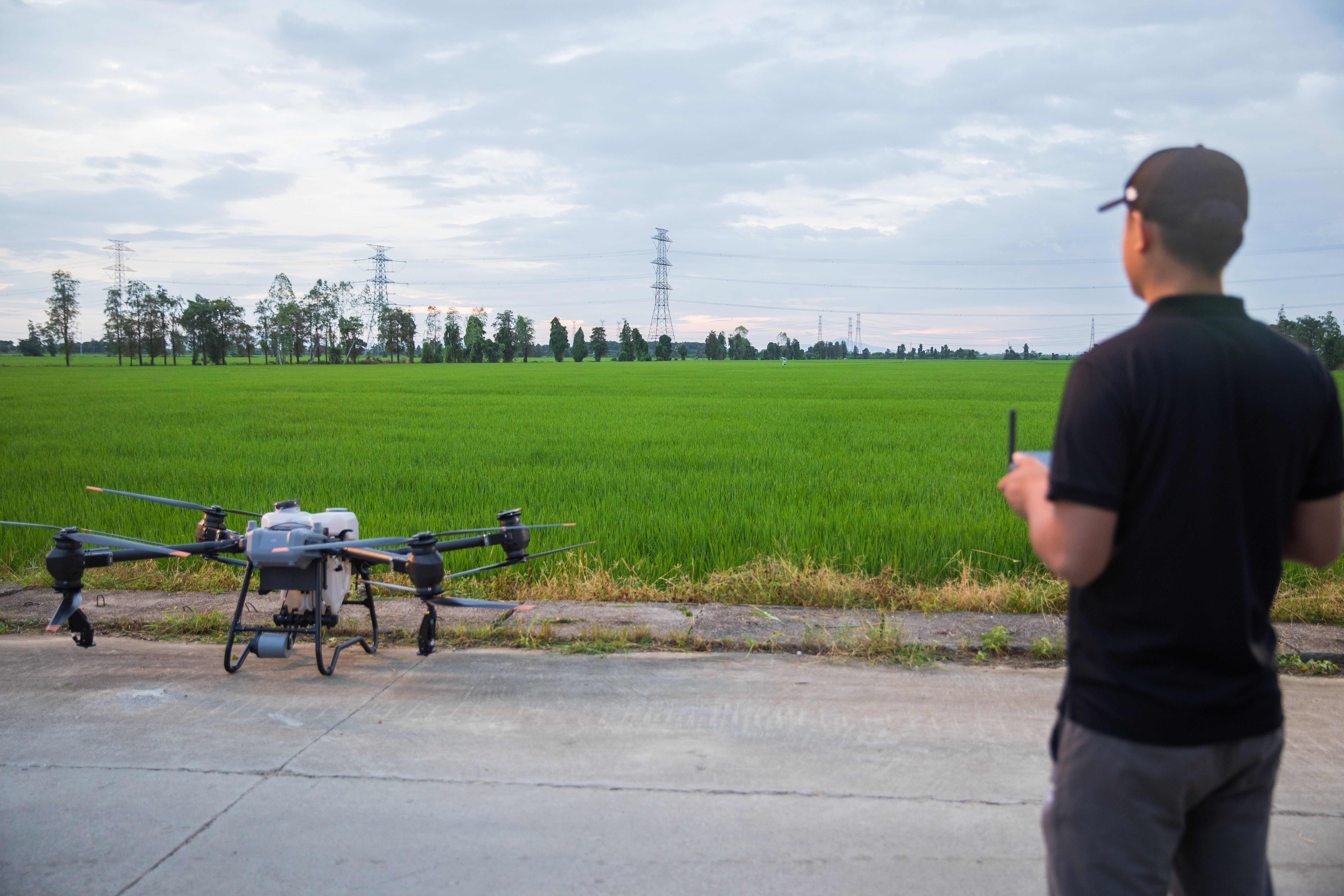
Aerial application is the process of applying crop inputs such as fertilizers, pesticides, fungicides, and nutrients from the air rather than from ground equipment. Traditionally, this was done using manned aircraft. Today, Agricultural Drone Services are redefining aerial application by delivering targeted, data-driven treatments at a fraction of the cost and risk.
Unlike traditional spraying methods, agricultural drones operate at low altitude with precise control over swath width, droplet size, and variable rate application. This allows growers to treat only the areas that need attention rather than blanket spraying entire fields.
Why Traditional Crop Application Is Failing California Farms
California growers face challenges that conventional application methods struggle to solve
- Soil compaction from heavy ground equipment
- Inaccessible or uneven terrain
- Rising labor and fuel costs
- Increasing environmental and regulatory pressure
- Input waste caused by over-application
Ground rigs cannot operate efficiently in wet fields, orchards, vineyards, or steep terrain. Manned aircraft are expensive, weather-dependent, and often over-apply chemicals.
These issues directly impact yield, compliance, and profitability.
How Agricultural Drone Services Solve These Problems
Agricultural Drone Services provide a precision-first alternative designed for California’s diverse farming environments.
Key advantages include
- Low-altitude application reduces drift
- RTK-enabled flight accuracy improves targeting
- Variable rate application minimizes chemical waste
- No soil compaction or crop damage
- Faster deployment than traditional aircraft
Drone crop spraying allows growers to apply inputs exactly where needed, when needed, and in the correct amounts.
How to Reduce Pesticide Waste With Drone Mapping
One of the most powerful advantages of modern aerial application is drone-based mapping.
Using multispectral sensors, drones generate NDVI maps that reveal plant stress, nutrient deficiencies, and irrigation issues invisible to the naked eye.
How it works
- Multispectral drones scan the field
- NDVI data highlights problem zones
- Application maps are created
- Targeted spraying is performed only where needed
This approach dramatically reduces pesticide and fertilizer use while improving crop response.
For research-backed validation, see guidance from bold University of California Agriculture and Natural Resources Extension and bold USDA precision agriculture resources.
Precision Agricultural Drone Services in California Regions
California agricultural diversity makes drones uniquely effective.
Examples of geo-specific use cases
- Drone crop spraying in Kern County orchards
- Precision application in Central Valley row crops
- Vineyard spot treatments in San Luis Obispo County
- Vegetable fields in Imperial and Riverside counties
Each region presents unique challenges related to terrain, wind, crop density, and regulatory oversight. Agricultural drones adapt to these conditions with programmable flight paths and adjustable swath widths.
Real-World Case Study: Drone Crop Spraying in Kern County
Mission Overview
- Crop: Wheat
- Area: 200 acres
- Location: Kern County, California
Objective
Identify nutrient deficiencies and reduce nitrogen over-application.
Process
- Conducted multispectral drone survey
- Generated NDVI maps identifying low-vigor zones
- Designed variable rate application plan
- Applied targeted nitrogen using agricultural drones
Results
- Identified nitrogen deficiency in 200 acres of wheat
- Reduced nitrogen usage by 22 percent
- Improved crop uniformity within two weeks
- Eliminated equipment traffic in sensitive areas
Original mission photos and NDVI outputs are documented internally and available upon request for verification.
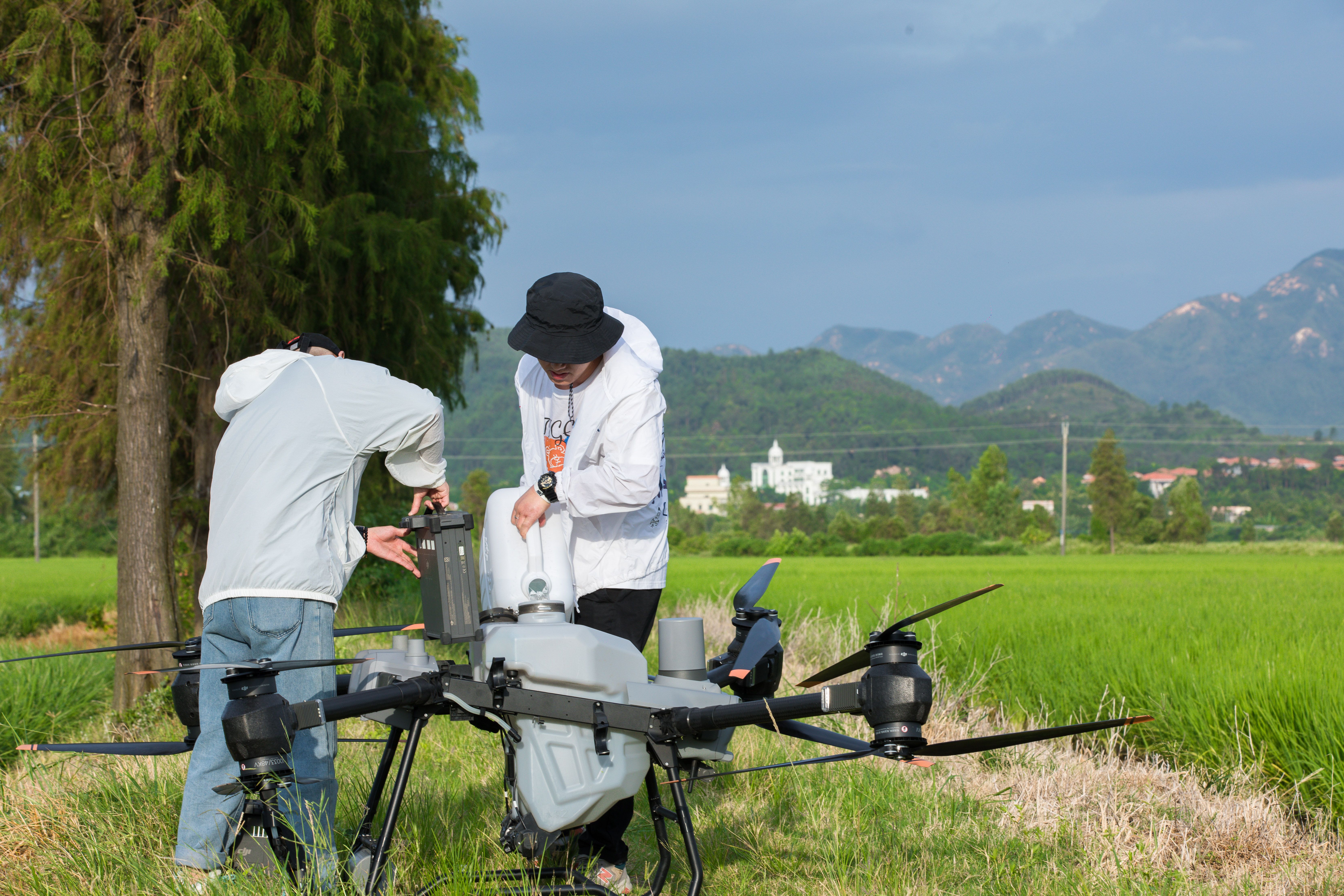
The Technology Behind Agricultural Drone Services
Modern agricultural drones are not hobby equipment. They are industrial platforms engineered for precision farming.
Key technologies used
- RTK precision for centimeter-level accuracy
- Adjustable swath width for consistent coverage
- Variable rate application controllers
- Terrain-following radar
- Redundant safety systems
Current comparisons show that newer platforms such as DJI Agras T50 outperform older models in payload capacity, battery efficiency, and spray uniformity.
This content should be reviewed annually as drone hardware and regulations evolve.
Safety, Compliance, and Chemical Handling Standards
Professional Agricultural Drone Services operate under strict safety and regulatory protocols.
Standards include:
- FAA Part 107 certification
- State agricultural chemical handling compliance
- Documented flight logs and maintenance records
- Pre-mission risk assessments
- Controlled loading and mixing procedures
All pilots are licensed and insured, with documented flight hours and application experience.
Author credentials include FAA Part 107 certification and extensive agricultural flight operations. A full author bio with credentials and flight hours should be linked from this post.
Why California Farmers Are Switching to Agricultural Drone Services
Growers are adopting drones because they deliver measurable results.
Benefits include:
- Lower per-acre application costs
- Reduced chemical waste
- Improved regulatory compliance
- Faster response to crop issues
- Increased operational flexibility
Aerial application is no longer about speed alone. It is about precision, data, and accountability.
Frequently Asked Questions
Are agricultural drones legal in California?
Yes. When operated by licensed pilots following FAA and state regulations, agricultural drone services are fully legal.
Can drones replace traditional crop spraying?
Drones complement and, in many cases, outperform traditional methods, especially for targeted applications and difficult terrain.
How accurate is drone spraying?
With RTK positioning and variable rate controls, drones deliver highly accurate applications with minimal drift.
What crops benefit most from aerial application?
Row crops, orchards, vineyards, vegetables, and specialty crops all benefit from precision drone services.
Next Steps for Growers
If you are considering Agricultural Drone Services for your operation, the next step is evaluation, not guesswork.
Actionable options
- Download our Spraying Efficiency Checklist
- Book a Free Acreage Assessment
- Request a precision mapping demo
Aerial application is no longer the future of farming in California. It is already here.